Alan Godfrey Maps
Manchester (Victoria Park & Longsight) 1916
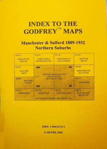
Code:Godfrey Map Number 104.15b. As well as Victoria Park and Longsight, this map also covers parts of Chorlton on Medlock, Moss Side and Rusholme. The map shows highly populated areas of mainly terraced houses with a few Semi and detached houses. On the left of the map starting at Bridge St. top end of Oxford Rd. down to Claremont Rd. at the bottom and on the extreme right of the map at the top is part of Hyde Rd. down to Duncan Rd. Longsight. It includes: Victoria University (Owens College), Royal Eye Hospital, Royal Infirmary and St Mary’s Hospital on Oxford Road; Whitworth Park; Britannia Quilt Works on Great Southern St; Longsight; Sidings; St Joseph’s Boys’ Industrial Schools on Plymouth Grove. Also includes: Churches – Holy Name RC Ackers St, St Saviours off Dryden St, St Joseph’s RC Plymouth Grove, St John’s on St John’s Rd, etc.