Alan Godfrey Maps
Liverpool (London Road) 1848-64
Code:
£3.50
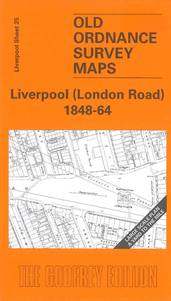
Godfrey Map Number 25. Liverpool (London Road) 1848-64. The second in the Liverpool large scale 36 inches to 1 mile series. Extends west to east from Lime Street to Ardwick Street and Elizabeth Street, north to south from Islington Street to the lunatic asylum. Works include timber yards, oil works, flag yard, coach factory. There are Schools for the Indigent Blind and an infirmary. Churches include St Jude's, Christ Church and St Nicholas RC Chapel.